Storm Eunice: Weather warnings extended to Saturday as expert warns winds could ‘sweep people off streets’
Residents in red alert areas should be ‘battening down the hatches’, according to Professor Hannah Cloke

Sign up to the Independent Climate email for the latest advice on saving the planet
Get our free Climate email
Weather warnings have been extended to Saturday in parts of the UK, as the Met Office warns strong winds could hamper the clear up following Storm Eunice.
The latest yellow alert covers much of the south coast of England, south Wales, and the west country.
Power cuts could be “prolonged” and repairs to infrastructure could be held up by the continued high winds, the Met Office said.
The warning is in place from 6am to 6pm on Saturday.
The Met Office said: “A short-lived area of strong winds looks likely to track quickly eastwards across southern parts of England and Wales on Saturday, accompanied by a spell of heavy rain.
“The strongest winds are expected through the Bristol Channel and along the south coast of England with gusts of 60 mph likely here, and 40 to 50 mph inland.
“The winds themselves could cause minor disruption; but given the expected impact from Storm Eunice on Friday, these conditions on Saturday may hamper any clear-up operations.”
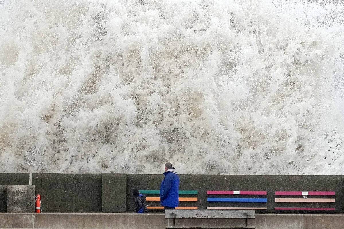
Storm Eunice is set bring gusts of up to 90mph, and a red warning – the highest level – has been issued for parts of south-west England and south Wales from 7am to midnight on Friday.
The Met Office said there is a risk of “flying debris resulting in danger to life” and “damage to buildings and homes, with roofs blown off and power lines brought down”.
People living in red alert areas should be “battening down the hatches”, according to Professor Hannah Cloke, natural hazards researcher and hydrologist at the University of Reading.
She warned high winds could “sweep people and vehicles off streets” and said the alerts should not be taken lightly.
“Everyone who lives or works in those areas should be battening down the hatches, literally in some cases, to prevent people from being killed and injured and to protect your homes and businesses,” she said.
“Winds of 70mph will uproot trees, which can block roads and crush cars or buildings. They can pick up roof tiles and hurl them around. If you’re hit by one of those you will be seriously hurt or killed.
“Wind that strong will sweep people and vehicles off streets, and topple electricity lines.”
She urged people to stay inside and avoid taking risks.
The red alert has been issued by the Met Office due to the combination of high tides, strong winds and a storm surge.
The warning covers the coastline of Devon, Cornwall and Somerset as well as the south coast of Wales.
Amber warnings, the second highest alert level, are in place for wind across the whole of England from 5am to 9pm on Friday, while yellow weather warnings, the next level down, for wind and snow are in force for a large part of Scotland - where blizzards are predicted - and the whole of Northern Ireland.
Severe flooding may also take place along the coastlines of the South and West of England as spring tides are expected on Friday morning.
Subscribe to Independent Premium to bookmark this article
Want to bookmark your favourite articles and stories to read or reference later? Start your Independent Premium subscription today.
Join our commenting forum
Join thought-provoking conversations, follow other Independent readers and see their replies