Met Office warning of strong winds exceeding 60mph as parts of England remain at risk of flooding
As the country recovers from the impact of torrential rain and flooding, the Met Office has issued a new weather warning for wind on Sunday
Your support helps us to tell the story
From reproductive rights to climate change to Big Tech, The Independent is on the ground when the story is developing. Whether it's investigating the financials of Elon Musk's pro-Trump PAC or producing our latest documentary, 'The A Word', which shines a light on the American women fighting for reproductive rights, we know how important it is to parse out the facts from the messaging.
At such a critical moment in US history, we need reporters on the ground. Your donation allows us to keep sending journalists to speak to both sides of the story.
The Independent is trusted by Americans across the entire political spectrum. And unlike many other quality news outlets, we choose not to lock Americans out of our reporting and analysis with paywalls. We believe quality journalism should be available to everyone, paid for by those who can afford it.
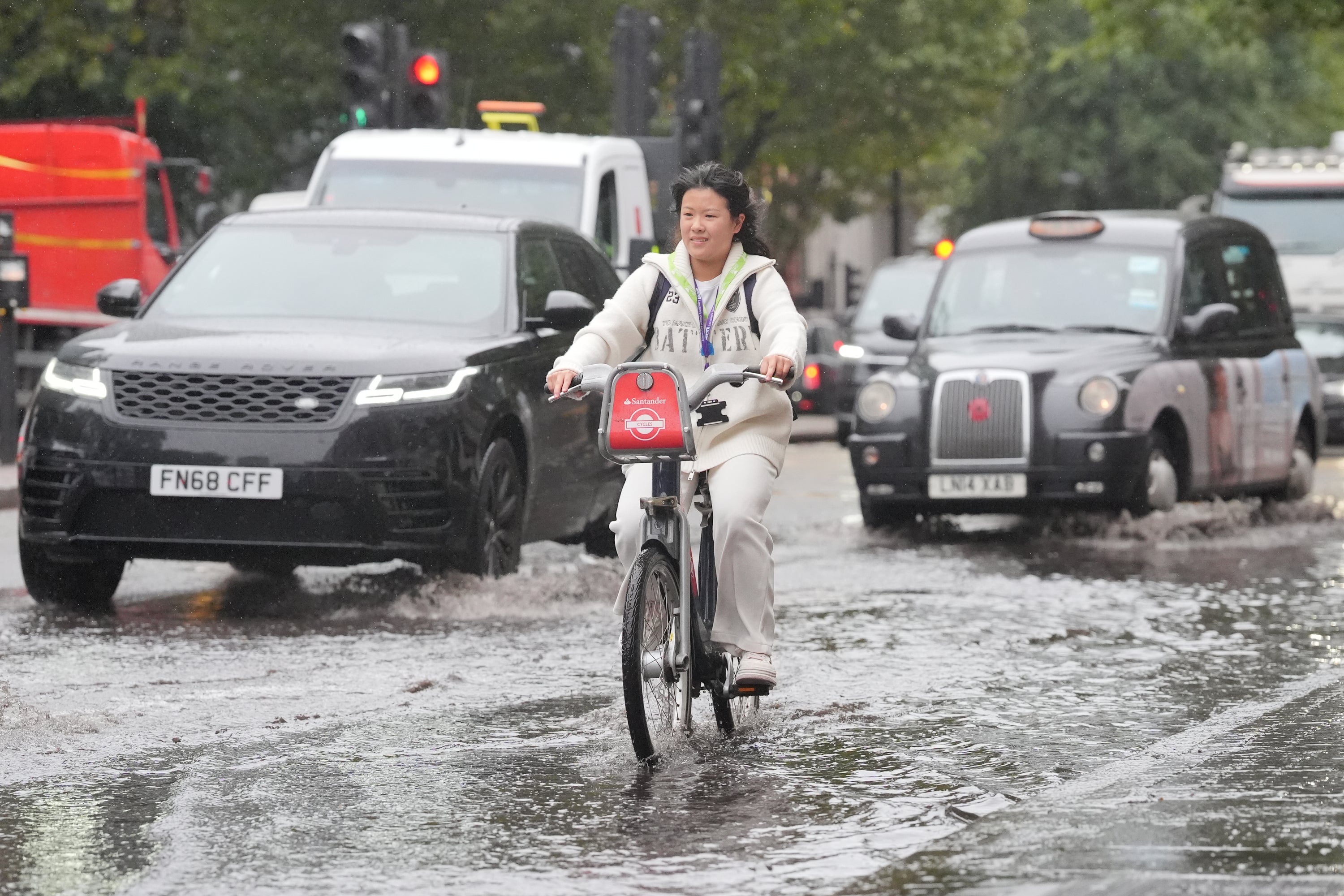
Your support makes all the difference.The Met Office has issued a weather warning for winds of more than 60mph this weekend as parts of England slowly recover from the impact of torrential rain and flooding.
Following widespread disruption caused by the heavy downpours on Thursday, problems on the roads and railways gradually eased over Friday and most can expect dry conditions on Saturday.
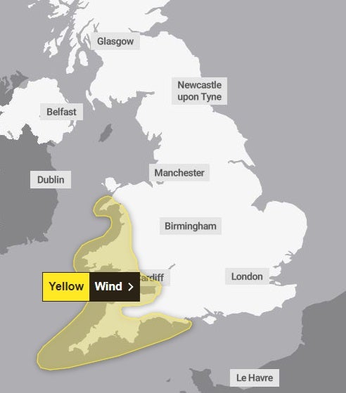
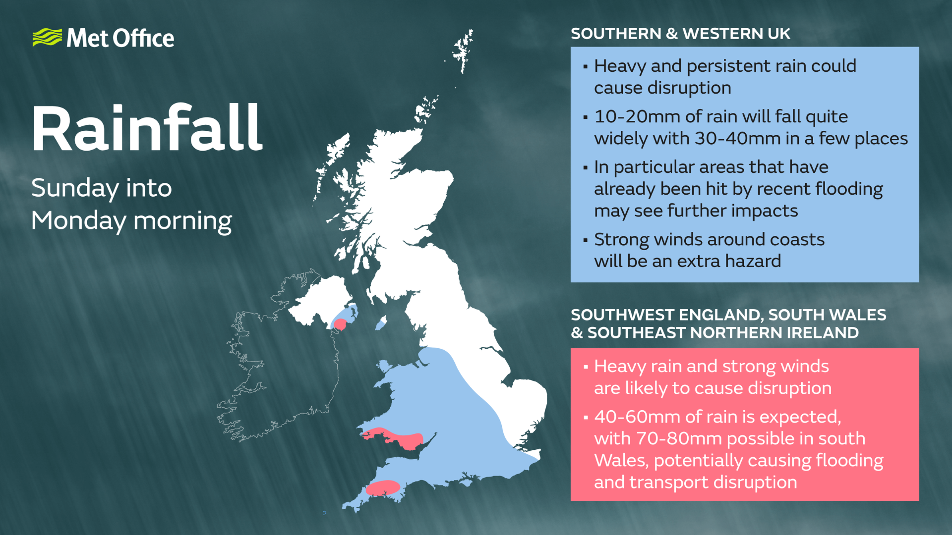
However, on Sunday, the Met Office is forecasting more heavy rain for the southern and western parts of the country and Wales. A yellow weather warning is in place for strong winds for some of the region from 9am to midnight.
Winds will strengthen from west to east with gusts of 50-55 mph likely in places, exceeding 60mph, in the most exposed areas, the Met Office has said.
The continued unsettled weather could potentially bring more misery to communities that have already dealt with flash flooding caused by the heavy rain over the past week.
On Friday morning, rail services between Shrewsbury in Shropshire and Wolverhampton in the West Midlands were cancelled after severe flooding at Wellington station and a tree on the line.
The pitch at the SEAH Stadium in Wellington, home to Telford United football club, was completely flooded on Thursday evening.
Trains between Peterborough in the East Midlands and London King’s Cross were also delayed because of flooding. On Friday afternoon, the line between Bristol and Swindon was also blocked due to flooding.
The Marston Vale line in Bedfordshire, which operates services between Bedford and Bletchley, is suspended until Monday because of standing water on the track.
On the roads, three people had to be rescued from their cars after becoming stranded on the M5 near Bristol due to flooding. Around 6,000 litres of water per minute had to be removed from the motorway during a full closure.
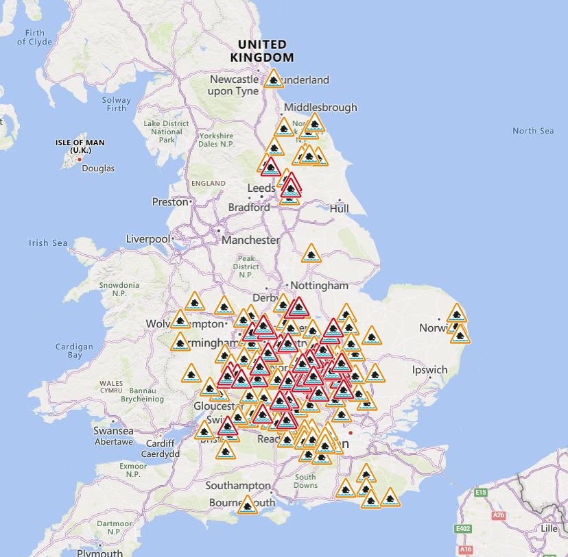
Despite the rain disappearing on Friday, the Environment Agency still had 59 flood warnings in place, meaning flooding was likely, across England.
The agency said about 650 properties were flooded in Hertfordshire, Bedfordshire, Northamptonshire, Kent and the home counties have been flooded.
Minor river flooding is now expected in Northamptonshire, Cambridgeshire, Worcestershire, Bedfordshire, Gloucestershire, and also in Yorkshire.
Meteorologist Greg Dewhurst: “There will continue to be localised flooding. A lot of these areas have been hit by rain in the past few weeks which means the ground is already saturated.”
Looking further afield, the Met Office said the weather should become “somewhat drier and brighter more widely around midweek”.
Join our commenting forum
Join thought-provoking conversations, follow other Independent readers and see their replies
Comments