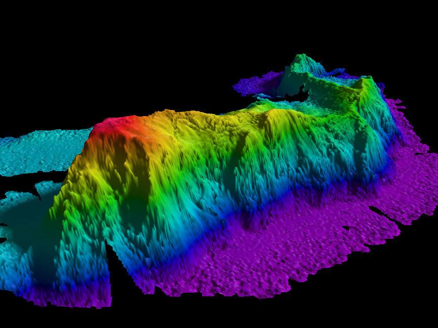
Thousands of uncharted mountains discovered in Earth’s oceans
Up to 10,000 new seamounts found using data collected by satellites above planet

Your support helps us to tell the story
From reproductive rights to climate change to Big Tech, The Independent is on the ground when the story is developing. Whether it's investigating the financials of Elon Musk's pro-Trump PAC or producing our latest documentary, 'The A Word', which shines a light on the American women fighting for reproductive rights, we know how important it is to parse out the facts from the messaging.
At such a critical moment in US history, we need reporters on the ground. Your donation allows us to keep sending journalists to speak to both sides of the story.
The Independent is trusted by Americans across the entire political spectrum. And unlike many other quality news outlets, we choose not to lock Americans out of our reporting and analysis with paywalls. We believe quality journalism should be available to everyone, paid for by those who can afford it.
Your support makes all the difference.More than 5,000 previously undiscovered underwater mountains have been revealed in the most complete chart of the ocean floor ever made.
These “seamounts” (a mountain rising from the sea floor that does not reach sea level) were traced using data collected by satellites high above the planet, which can detect slight changes in the ocean surface caused by structures deep below.
The exact number still needs to be finalised – but the true total may be as many as 10,000.
A team led by Dr David Sandwell and Dr Brook Tozer at the Scripps Institution of Oceanography in California was behind the new map, which could be used to make predictions about future climate change and tsunamis.
In 2005, a US nuclear submarine collided at full speed with a previously undetected seamount near Guam, revealing the extent to which this environment is still largely a mystery.
Dr Sandwell told New Scientist about their new work, explaining that enormous progress had been made in the resolution of seamount mapping.
While five years ago scientists were capable of detecting all structures greater than 2km (1.2 miles) tall using satellite data, they are now able to detect anything above 1.5km (0.9 miles).
He said there will probably be thousands more seamounts discovered after Nasa’s Swot (surface water ocean topography) satellite – which can detect anything down to 1km (0.6 miles) high – is launched in two years’ time.
Another project, the United Nations-backed Seabed 2030 initiative, has been set up to create a high-resolution chart of the underwater environment comparable with existing efforts to map the land.
The team behind the project intends to gather data from a wide range of countries and private companies to create a freely accessible depiction of the ocean floor.
This could involve equipping fishing vessels and other boats with acoustic devices that capture information about water depth and send it back to the scientists.
Seabed 2030 launched in 2017 and is expected to cost around $3 billion (£2.3bn).
Join our commenting forum
Join thought-provoking conversations, follow other Independent readers and see their replies
Comments