In photos: A glacier’s collapse shows climate change impact in Greenland
‘It was so overwhelming to watch billions of tons of ice collapse all at once. Suddenly it didn’t feel like a small or distant problem,’ says Lucas Jackson

Sign up to the Independent Climate email for the latest advice on saving the planet
Get our free Climate email
Perched on a cliff above Greenland’s Helheim glacier, I try calling my wife in New York on a satellite phone. Before I can leave a message, an explosion breaks the Arctic silence.
More explosions follow.
I run across a muddy tundra to a video camera on a tripod overlooking the glacier and rip off the trash bag I’ve been using to protect it. I hit record as fast as I can focus.
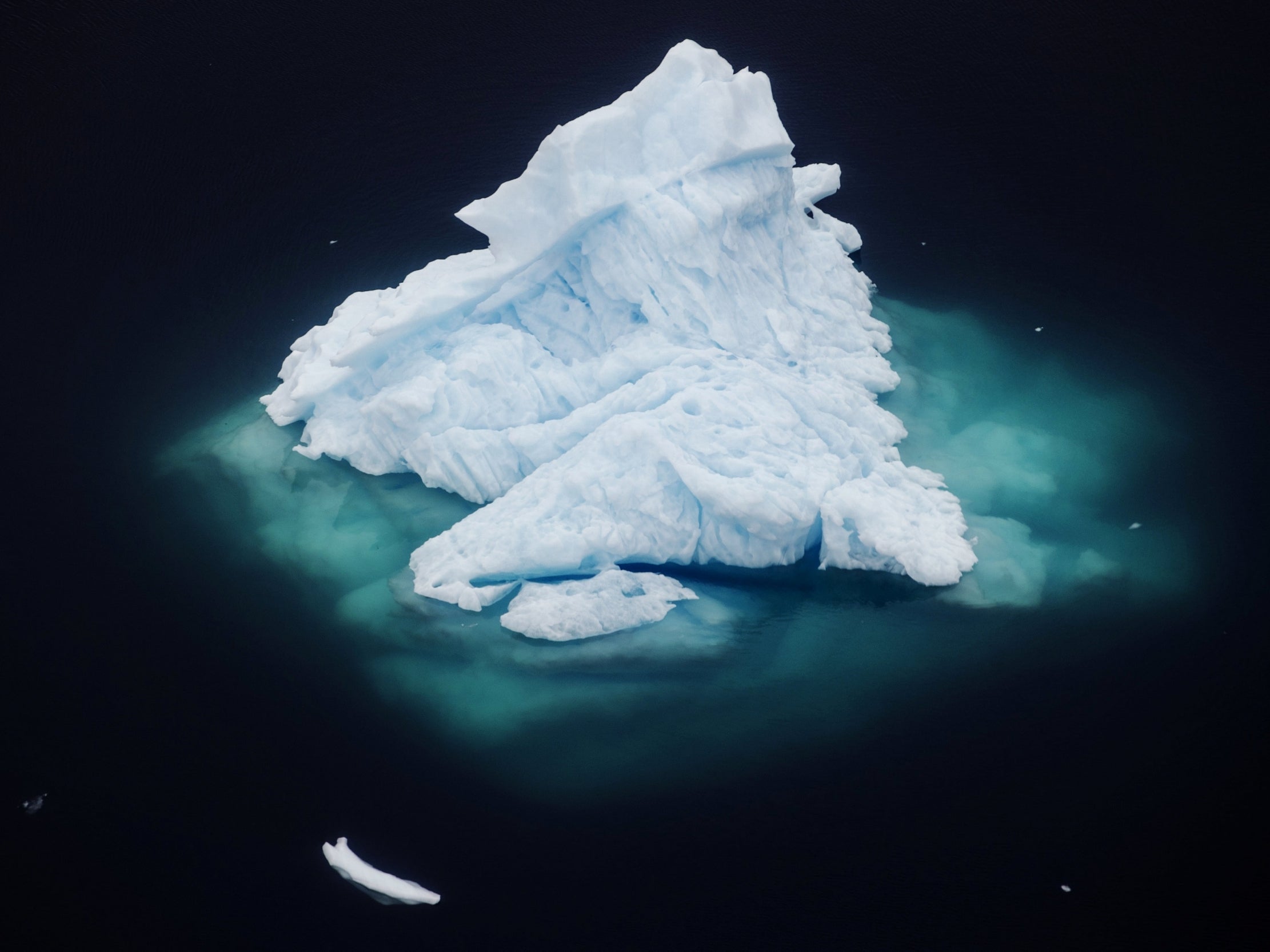
The popping sounds morph into a low rumble. Over the next half hour, the ice breaks apart and a four-mile-wide chunk tumbles into the sea in a process called calving – one rarely witnessed on this scale.
As a Reuters photographer, I have captured erupting volcanoes, the aftermath of hurricanes and tornadoes, and war, but I have never felt so small. It was a poignant end to a months-long project examining climate change in Greenland.
The idea was to follow scientists conducting climate research. They have had the computational power to understand global warming for only a few decades, and the numbers are sobering. But where does the data come from?
To find out, we turned to a team of scientists flying out of Iceland affiliated with a Nasa project named Oceans Melting Greenland. They aim to understand how warming oceans are melting the island’s ice from below.
We also spent time with New York University oceanographer David Holland, who was there on a separate research project and also witnessed the Helheim glacier calving.
Glacier collapse shows climate impact
Show all 20I realise the scale of this work while aboard a Nasa research aircraft with principal investigator Joshua Willis and other scientists, at 40,000 feet (12,192 metres), looking out at the seemingly infinite white horizon of the Greenland ice cap.
The plane banks and loops above the craggy cliffs and rock faces of eastern Greenland that are slowly being ground to dust by immense glaciers.
I joined the Nasa team for a week in March in Keflavik, Iceland. Each day we took off from icy runways and flew over Greenland’s coast, as scientists Tim Miller, Ron Muellerschoen, and David Austerberry collected a seemingly endless stream of numbers, symbols, and letters on their computers from radar data on glacier formations.
NYU’s Holland has been studying Helheim and another glacier named Jakobshavn for more than a decade.
This June, I went along as he visited the Helheim glacier, near the seaside village of Tasiilaq, with a population of about 2,000. Remarkably, it has managed to become something of a tourist destination, an accomplishment with just two hotels, both of which sometimes serve whale meat.
Transportation here is limited to boat or helicopter in the summer and dog sled in the winter. In the summer, the sun sets for only a couple of hours each day.
Holland is gathering data on seismic activity, temperature and wind, along with timelapse pictures.
For both journalists and scientists, climate change is difficult to document. It most often happens imperceptibly – a tenth of a degree increase in temperature, a few less inches of rain, a slowly melting ice sheet.
That’s why it was so overwhelming to watch billions of tons of ice collapse at all once. Suddenly it didn’t feel like a small or distant problem.
Reuters
Subscribe to Independent Premium to bookmark this article
Want to bookmark your favourite articles and stories to read or reference later? Start your Independent Premium subscription today.
Join our commenting forum
Join thought-provoking conversations, follow other Independent readers and see their replies